As you read this story, you will learn the following:
-
Using a suite of technological tools, researchers are searching for Neolithic burials and settlements hidden beneath the landscape of the Czech Republic.
-
Burial sites are often invisible to the naked eye, but remote sensing techniques highlight subtle landscape differences.
-
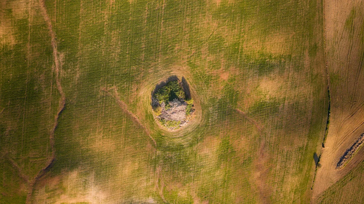
These 5,000-year-old tombs sit just outside the ancient settlement area.
Beneath the Czech Republic’s Bohemian farmland lurk thousands of archaeological sites, including dozens of Neolithic tombs, many as old as 5,000 years old. It’s impossible to see them just by looking at them, but a set of techniques has now revealed for the first time some of Europe’s oldest monumental structures.
Experts had realized that tumuli – elongated burials common around 3000 BC – were scattered throughout Bohemia, but they just couldn’t see them. Fortunately, a new study published in archaeological exploration have shown how remote sensing strategies can bring these once-hidden prehistoric burial monuments into view and even reveal areas of settlement surrounding these sites.
By combining aerial surveys, magnetic surveys and airborne laser scanning, “it is possible not only to detect burial monuments that are no longer identifiable in today’s terrain, but also to reconstruct key aspects of their original form, state of preservation and landscape context,” the authors write.
A team of Czech researchers led by the Institute of Archeology at the University of Wroclaw, in collaboration with the Universities of Pilsen, Hradec Kralov and Prague, captured patterns of crop growth, pinpointed centimeter-level elevation changes and mapped changes in soil magnetism using ground-based magnetometry. This combination reveals a completely new Neolithic topographic landscape, even within an intensively cultivated landscape.
“Aerial imagery, especially oblique photographs, remains essential for identifying the long barrow’s characteristic plan, while magnetic surveys have provided important insights into its internal structure, tectonic elements and associated features, including burial pits obscured by extensive frontal cropping marks,” the authors write.
The team found approximately 2,900 archaeological features in four main clusters in the study area. These include the tell-tale signs of Neolithic long barrows, some of the earliest monumental tombs ever built in Central Europe. Experts said that in addition to the tombs, they also found other circular monuments and tomb-related structures at the site, which help illustrate the funerary customs of the time.
The monuments and structures under study acted as “ritual anchors in the landscape”, with evidence showing how prehistoric communities regularly returned to these sites and reused them over centuries. “In this sense,” the authors write, “the long Neolithic carts formed the core of an enduring ritual.”
The findings gave the team new insights into the typical framework of the settlement and how the burials fit into it, and provided strong evidence that the long barrows were “deliberately built on the edge of the settlement.” The team often found burial sites pushed out into the suburbs, up to 1,500 feet away from neighborhoods, creating intentional buffer zones between the living and the buried. This spatial separation has long been theorized, but now technology has confirmed it for the first time.
“The results highlight the value of multi-method remote sensing not only as a site detection tool but also as a means of reconstructing prehistoric land use strategies and social practices,” the team writes. “In the case of the Bohemian Barrow, remote sensing reveals a landscape structured by persistent conceptual divisions between the realms of the living and the dead—divisions that have been maintained and renegotiated over millennia.”
Even in areas where intensive agriculture has long been thought to have eliminated prehistoric monumental architecture, important traces of Neolithic burial monuments and their associated landscapes remain. “Their detection and interpretation do not rely on a single best approach,” they write, “but rather on a systematic integration of complementary remote sensing technologies.”
You may also like