Keep your snow shovel and winter coat for a few extra days.
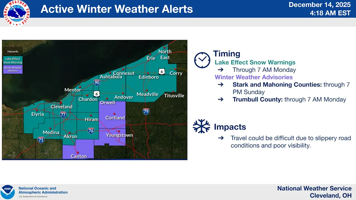
The National Weather Service has called for a lake effect snowfall warning until 7 a.m. Monday for several Northeast Ohio counties, including Summit, Portage, Medina and Cuyahoga.
An additional 1 to 3 inches of snow is expected in Summit and Medina counties, and 2 to 4 inches in Portage County.
Periodic snowfall amounts of up to 1 inch per hour are expected by this evening, according to the National Weather Service. The most persistent snow will affect northeastern Lorain, northern Medina, northern and western Portage County and central Summit County. Roads, especially bridges and overpasses, can become slick and dangerous. Visibility may drop to less than a quarter mile due to falling and blowing snow.

An additional 3 to 6 inches of snow is expected, with 7 to 8 inches possible where snow bands persist, according to the National Weather Service.
National Weather Service, Ohio Department of Transportation urge caution when going out
The National Weather Service said in the alert that people should consider postponing all travel. If travel is necessary, motorists should drive with extra caution and consider carrying a winter storm kit that includes items such as snow chains, booster cables, flashlights, shovels, blankets and extra clothing. Also bring water, a first aid kit, and other items that will help in an emergency.
The Ohio Department of Transportation and the Ohio Turnpike and Infrastructure Commission strongly encourage motorists to heed all travel restrictions and postpone nonessential travel. Please visit www.ohgo.com for the latest travel, road and traffic conditions.
An additional 3 to 6 inches of snow is expected, with 7 to 8 inches possible where snow bands persist, according to the National Weather Service.
How much snow does the area get? Heights reported to reach 7 inches in some areas
When some areas woke up, it was completely white outside. According to the National Weather Service’s local storm report at 9:23 a.m., the following snow reports have been recorded so far:
-
North Ridgeville 3.8 inches.
-
3.4 inches in Streetsboro.
-
Strongsville 7 inches.
The cold wind adds an extra chill to the air
Snowstorms aren’t the only concern for those venturing out. Today’s high is expected to be near 20 degrees, with wind chill values as low as -3 degrees, according to the National Weather Service. Wind gusts could reach 30 mph. The minimum temperature tonight is expected to be around 11 degrees.
The maximum temperature on Monday is expected to be close to 21 degrees, with a 20% chance of precipitation between 7am and 1pm, and the minimum temperature tomorrow is expected to be around 11 degrees.
This article originally appeared in the Akron Beacon Journal: Several counties under lake effect snow warning as of early Monday
