


The National Weather Service has issued two new winter weather warnings as heavy snow and dangerous winds combine to create severe winter storms
The National Weather Service announced on Saturday, February 7, that “a moderate atmospheric river event affecting the Pacific Northwest tonight will push further inland Sunday and Monday into portions of the northern Rockies and impact areas as far south as northern California.”
Coastal areas of Washington, Oregon and northwest California will see heavy rain, but inland the highlands of the Cascade Mountains and northern Rockies are expected to see up to two feet of snow.
2 states to see 24 inches of snow
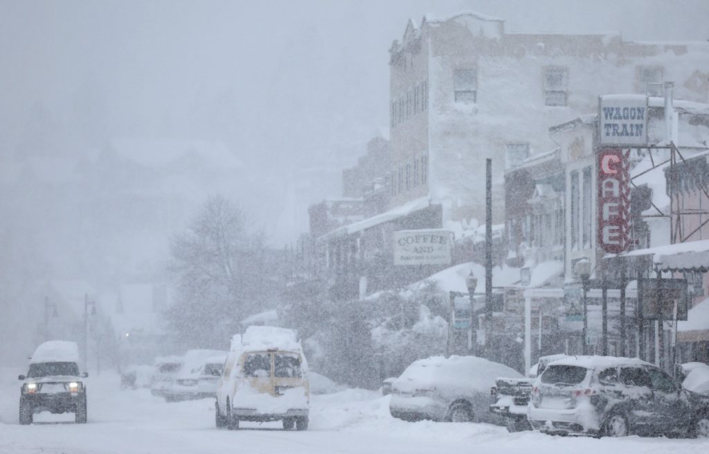
The border between California and Nevada is expected to feel the brunt of the storm, putting cities like Truckee and Lake Tahoe at risk as heavy snow and dangerous winds approach.
“10 to 18 inches of snow above 7,000 feet. 4 to 6 inches at Lake Tahoe and 6 to 12 inches along and west of Highway 89,” the National Weather Service forecast said. “Gusts as high as 35 mph, with gusts up to 70 mph along the top of the Sierra. Wave heights in Lake Tahoe will be 1 to 3 feet.”
The National Weather Service also warned against traveling in the area and issued additional warnings for people who own boats or other water equipment in the area.
“Travel may be difficult. Hazardous conditions may affect the Tuesday morning and evening commute. Strong winds may blow down tree branches. Boats, kayaks and paddleboards can easily capsize and should stay off the lake until conditions improve,” the company said in a statement.
A second storm is expected to hit the area again next weekend.
We encourage those in the path of the storm to winterize outdoor faucets, apply these solutions to insulated windows, prepare roofs for snow removal, and salt driveways and sidewalks in a way that is safe for children and pets.
RELATED: Travis Kelce’s retirement decision gets big update
This story was originally published on men’s magazine It first appeared on February 8, 2026 information part. Add Men’s Diary as For preferred sources please click here.