


Introduction
-
Currently, about 1 inch of snow has fallen in parts of the city, with nearly 9 inches falling in the northwest suburbs.
-
The highest totals so far include 8.8 inches in East Nantmeal Township, 8.7 inches in Blue Bell Township and 8.5 inches in East Nottingham Township.
-
The latest data from the National Weather Service showed that as of 10:30 a.m., 3 to 5 inches of rain had fallen across much of Philadelphia and nearby suburbs.
Philadelphia – Snow fell rapidly in the Philadelphia area on Sunday, with new reports showing nearly 9 inches in some suburbs and several inches on the ground in much of the city.
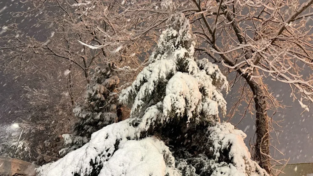
Snow in December in Willow Grove, Pennsylvania (Photo: Tyler Thrasher/FOX)
The latest public information statement issued by the National Weather Service office in Mount Holly at 10:36 a.m. Sunday showed snowfall totals significantly higher than early morning reports. Many neighborhoods that had 1 to 3 inches before sunrise have now reached the 5 to 8-inch range, especially in North and West Philadelphia.
Related: More than 5,500 PECO homes and businesses were without power Sunday as winter storm impacts the area
Center City saw 3.6 inches of snowfall, while northeastern communities such as Fox Chase, Bustleton and Somerton reported between 4 and 5 inches of snow. The official reading at Philadelphia International Airport was 1.3 inches, highlighting the steep gradient from the airport to the rest of the city.
The heaviest bands are concentrated in parts of Chester, Montgomery, Bucks, Lehigh, Carbon and Northampton counties, with several towns currently reporting 7 to 8 inches of thickness. Plowable snow also occurred in southern New Jersey and northern Delaware, with some communities seeing totals of 4 to 7 inches.
These totals are based on reports collected around 10:30 a.m. Sunday and may continue to rise in areas where snow is still falling.
Philadelphia area snowfall totals
Philadelphia
-
Rockledge (city boundary): 4.9″
-
Center City/Philadelphia (Observer): 3.6″
-
Philadelphia International Airport: 1.3″
Snow in December in Willow Grove, Pennsylvania (Photo: Tyler Thrasher/FOX)
Southeastern Pennsylvania
chester county
-
East Nottingham Twp: 8.5″
-
Atglen/West Sadsbury Twp: 7.8″
-
West Chester (2.4 SSE): 6.5 inches
montgomery county
-
Harleysville/Salford Twp: 7.5 inches
-
Pottstown area (including Stowe and Northeast Pottstown): 6.6″–7.3″
-
Willow Grove/Jenkintown Corridor: 6.0″–6.4″
bucks county
-
Doylestown (3.4 SW): 8.0″
-
Perkasie/Souderton/Trumbauersville: approximately 7.0″
-
Newtown / Langhorne area: about 6.0″
delaware county
Berks, Lehigh, Carbon and Northampton Counties
-
East Nantmeal/Alburtis/Earl Twp/Lake Harmony/Lehigh Twp (Carbon Fiber): Approx. 7.0″–8.0″
-
Coopersburg (Lehigh): 8.0″
-
Bethlehem Area: Approximately 6.0″
new jersey
burlington county
-
Mount Laurel/Burlington: 5.8″
-
Mount Holly (NWS Office): 3.6″
Camden and Gloucester Counties
-
Washington Twp (Gloucester): 5.5″
-
Monroe Twp (Gloucester): Approximately 4.0″
Atlantic, Salem and Cumberland Counties
-
Atlantic City International Airport: 0.6″
delaware
newcastle county
-
New Castle County Airport: 3.3″
kent county
-
Smyrna / Clayton / Cheswold area: approximately 2.0″
Related: Lehigh Valley Zoo cancels winter light show Sunday due to snow and cold
From a numerical perspective
-
Highest total to date: Southeast Temel Township (Chester County) 8.8 inches
-
Other outstanding totals: Blue Bell (Montgomery County) 8.7 inches, East Nottingham Township (Chester County) 8.5 inches, Doylestown area, Coopersburg and parts of Carbon County 8.0 inches
-
Philadelphia: Generally 3″–5″ from the airport, about 3.6″ from downtown, and up to 5.0″ from Fox Chase
-
Many suburbs: now in the 5″–8″ range, especially north and west of the city
what’s next
Snowfall continued to impact travel in the region on Sunday, with many neighborhoods and secondary roads still covered in snow or slushy. Drivers should plan for reduced visibility, slippery roads and extended driving times, especially in areas with more than 5 inches of snow accumulation.
source
This article is based on observed snowfall totals from the National Weather Service Mount Holly Public Information Statement.