


January is doing January things.
Arctic air mass blanketed much of the eastern United States on Tuesday, Jan. 20, as forecasters warned that a spreading winter storm was expected to spread large amounts of ice and snow over 2,000 miles across the country later this week, stretching from Texas to the Northeast.
But first, large amounts of arctic cold air and lake-effect snow will continue to affect parts of the Midwest, Great Lakes and Northeastern states through midweek, according to AccuWeather.
Dangerous cold, possible hypothermia
Cold temperatures were the main topic on Tuesday, January 20th. The National Weather Service warned on the morning of January 20 that in Minnesota, “dangerous wind chills of minus 38 degrees could cause frostbite to exposed skin in as little as 10 minutes.”
The weather service says this cold Arctic air mass will persist from the Midwest to the Northeast/Mid-Atlantic on January 20. Highs in the teens and 20s are 15 to 25 degrees below average.


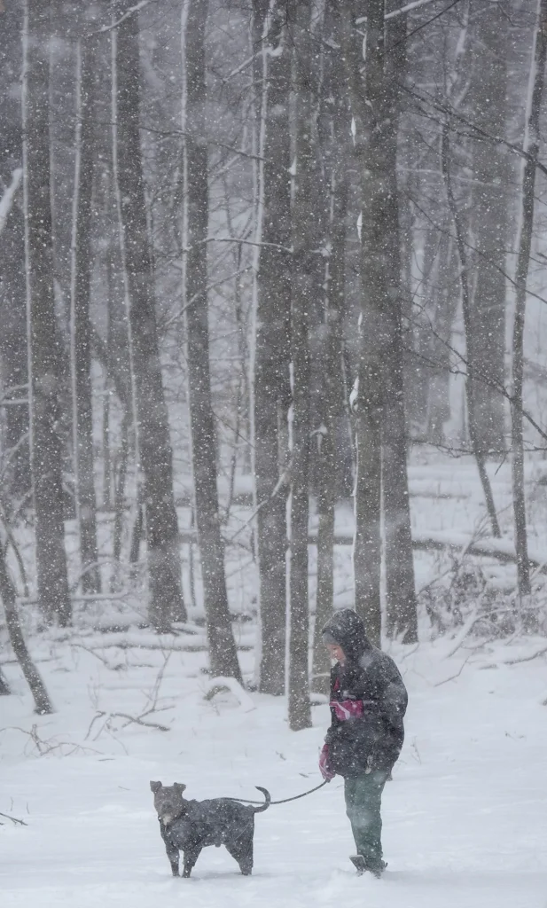
On January 15, 2026, a dog owner braved the winter cold for a hike in Akron’s Goodyear Heights City Park.
In the South, freezing to near-freezing temperatures prompted freeze warnings for Tuesday night from southern Georgia to central Florida.
As the cold persists and even intensifies as the week progresses, “the threat of frostbite and hypothermia will increase for anyone who spends time outdoors,” AccuWeather meteorologist Alyssa Glenny said in an online forecast. “Continued cold in the Arctic will also lead to increased heating and energy consumption in about one-third of the country.”
Winter storm is on the way
The Meteorological Service said on January 20: “Confidence that a large winter storm will affect much of the south and east of the country from Friday (January 23) to Sunday (January 25) continues to grow.”
Specifically, a widespread winter storm will produce swathes of heavy snow, sleet and dangerous freezing rain from the southern Rockies/Plains and south-central regions starting Friday and moving toward the East Coast by Sunday.
“On the south side of the system, significant amounts of freezing rain are expected, potentially causing hazardous travel conditions and power outages,” the weather service said.
According to AccuWeather, the exact formation and trajectory of this storm will determine the location of the ice and snow. Residents from Colorado and Wyoming to the mid-Atlantic and New England coast should remain vigilant for the latest weather forecasts, especially if ice threats are possible.
“Elements are being set up for a longer-lasting storm that will bring significant amounts of snow, sleet and freezing rain from Texas and the southern Plains later this week into the middle and lower Mississippi Valley and then into the East this weekend,” AccuWeather Senior Meteorologist Alex Sosnowski said.


The coming storm is expected to bring widespread snow and freezing rain.
warm west
Elsewhere, temperatures are set to be above average across the west this week.
AccuWeather said mid-January high temperatures will be 5 to 10 degrees above average in many areas, including Seattle, San Francisco and Salt Lake City. For reference, average daily high temperatures are in the 40s in Seattle, 50s in San Francisco, and 30s in Salt Lake City.
In some places, such as Los Angeles, temperatures will reach the 70s, or 5 to 10 degrees above historical averages.
In Phoenix, high temperatures will be mostly in the mid-70s to low 80s through the middle of the week.
In Las Vegas, highs will be in the mid-60s to near the mid-70s.
Doyle Rice is a national correspondent for USA TODAY, covering weather and climate.
This article originally appeared in USA TODAY: Arctic weather sweeps U.S., massive winter storm looms